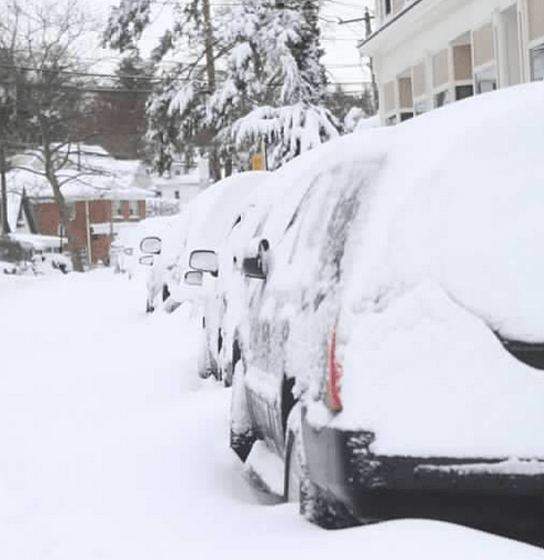
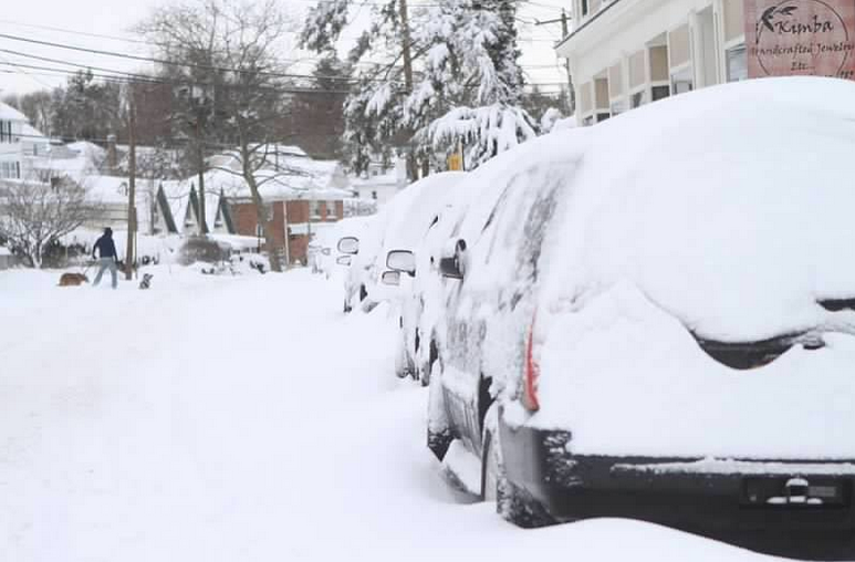
Long Islanders woke up Saturday to a mound of snow on their front yards, their cars swallowed by a white blanket and streets barely drivable as a powerful Nor’easter swooped in and dropped up to 30 inches of snow on the Island.
While many residents will have hours of shoveling ahead after the blizzard, most will be able to fire up some hot chocolate and huddle up next to their television screens because while this massive storm packed a punch, it didn’t come close to National Grid’s estimate of 100,000 customers losing power. In fact, as of 9 a.m., the total was a little less than 11,000 people in the dark.
But the storm was dangerous.
All major highways in Suffolk County had to be shut down to all non-emergency vehicles, including the Long Island Expressway, Sunrise Highway, Southern State, Northern State, Sagtikos/Sunken Meadow, Robert Moses Causeway, and Ocean Parkway.
There have been reports of abandoned vehicles throughout Suffolk County, making it difficult for emergency crews to plow roads and make roads passable.
CLICK HERE TO SEND US YOUR PHOTOS
A blizzard warning remains in effect in Suffolk County until noon Saturday.
The blizzard—dubbed Nemo by The Weather Channel—dealt a blow to public transportation as well, forcing the Long Island Rail Road to suspend service on five of its branches—Far Rockaway, Hempstead, Long Beach, Montauk and Oyster Bay—and limiting service on all others.
Those traveling by air also saw flight cancellations across all New York airports Friday evening. Flights at Islip’s Long Island MacArthur Airport are not scheduled to resume until 6:15 p.m. Saturday.
It was apparent Saturday morning that Suffolk County took the brunt of the storm.
The Nor’easter walloped communities from Lindenhurst to Upton, blasting at least 15 areas with more than 20 inches of snow. The National Weather Service reported that Upton saw 30.3 inches. (UPDATED SNOWFALL TOTALS)
Accumulation in Nassau barely reached the one-foot mark, the weather service reported. Bayville, Wantagh and Albertson were hit with more than 11 inches, while people in Seaford, New Hyde Park and Carle Place are likely mocking the storm as a bust after less than four inches fell on them. (UPDATED SNOWFALL TOTALS)
The storm also spawned whipping winds that contributed to outages and sent snow sideways making it difficult to walk at times. Strong winds—gusts were measured at more than 40 mph throughout the Island—also contributed to whiteout conditions making driving nearly impossible Friday evening.
Traffic was at a snail-like place and drivers reported excruciating travel times across all major roadways. On the Northern State Parkway Friday night, traffic was moving so slow that drivers were cleaning off their cars as they drove because snow was building up quickly. Some had to pull over under an overpass to move heavy snow off their cars.
The powerful storm forced New York Gov. Andrew Cuomo to declare state of emergencies in Nassau and Suffolk Counties Friday night.
Many of the outages are in the Town of Brookhaven, LIPA reported on its website, with more than 4,000 residents without power.
Two towns—Babylon and Islip—reported less than 100 customers without power.
Police and other local officials are urging drivers to stay off the roadways so crews can plow through the heavy snow. Drivers in Suffolk are told to use other roads since all major highways in the county are closed. It’s not yet clear when the highways will reopen.