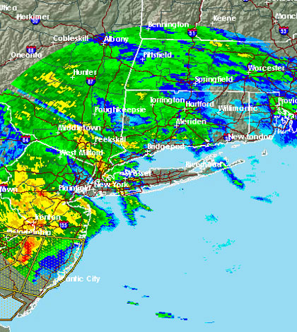
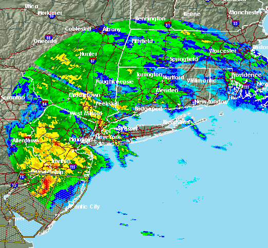
Break out the umbrellas—if they weren’t already destroyed by last week’s storm—because a serious storm moving toward Long Island could bring another 4 inches of rain to the already saturated area.
A flood watch is in effect for the entire island until Friday evening, according to the Upton-based National Weather Service, which is predicting the heaviest rainfall between 2 to 8 p.m. Thursday.
The initial batch will move across LI during the late morning hours before the sky opens up and unleashes a barrage of pouring rain.
“This system is expected to produce heavy rain at times with rainfall totals ranging from 2 to 3 inches with locally higher amounts…possibly up to 4 inches…during this time,” the NWS said in a statement. “This could result in urban and poor drainage flooding.”
The latest weather event comes less than a week after a record-breaking storm dropped a month’s worth of rain on the island in one day. Some areas saw upwards of 5 inches last Friday.
NWS meteorologist Joey Picca said they are not expecting the storm to produce similar results, but it will still be significant.
Isolated thunderstorms and dangerous lightning strikes are possible, he said. Long Islanders could also expect brief gusty winds in some areas.
And despite the hype, the storm is not expected to be a so-called derecho once it hits LI.
“What’s out there is not a derecho,” Picca said, noting that a storm of that caliber requires wind damage to extend more than 240 miles and include wind gusts of 58 mph.