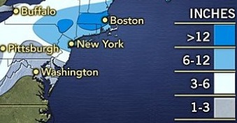
A winter storm is forecast to dump 4 to 8 inches of snow on Long Island, although exact amounts could change once the flakes start falling New Year’s Day through Friday.
Possible snow squalls on New Year’s Eve will preview a separate cold front moving in from the west that will blanket the region in white stuff, with the heaviest amounts hitting on Thursday, experts say.
“There’s still a good part of uncertainty,” Joey Picca, an Upton-based meteorologist with the National Weather Service, said Tuesday. “The good starting point seems to be 4 to 8 inches.”
Strong winds will accompany the about half-inch of slushy snow expected to hit Tuesday night, creating “brief white-out conditions,” the agency said in a statement. Once temperatures drop into the 20s after sundown there will be a potential for flash-freezing conditions that could make driving hazardous.
New Year’s Day will clear up before what the NWS described as a “prolonged period of snow” starts Wednesday night. Picca said the bulk of the snow will fall Thursday. Lingering snowfall Friday will give way to a bitter cold with wind chills as low as 0.
Once the storm is over, Saturday is forecast as mostly sunny in the 20s before another chance of rain and snow starts Sunday, when temps will be in the 40s.