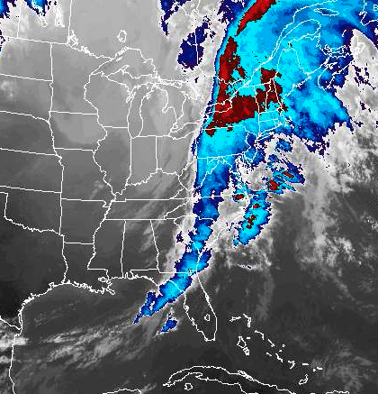
A system that brought unseasonably warm temperatures, heavy rain and strong wind, swept across Long Island Saturday and knocked out power to hundreds of PSEG Long Island customers as the Island prepared for another episode of heavy rain through the evening.
PSEG Long Island, which took over the electric grid for LIPA on Jan. 1, was able to quickly restore the majority of the outages. As of 4:17 p.m., 202 customers were in the dark, according to the utility’s outage map.
In a special weather statement issued Saturday afternoon, the National Weather Service in Upton warned Long Islanders to brace for heavy rain, possibly between 1 and 2 inches.
The agency said a low pressure system moving into eastern Canada will drag a cold front through the region late in the evening.
“This system will…produce heavy rainfall this afternoon through this evening,” the weather service said.
A flood watch is in effect for all of Long Island through late Saturday night, while a wind advisory is expected to last until 10 p.m.
Forecasters said small stream and river flooding is possible during the duration of the storm.
A dense fog that fell over LI Saturday is also expected to continue with visibility at a mile or less, forecaster said.
“Anyone driving should exercise extra caution and be prepared for rapidly changing visibilities,” the weather service said. “Drive extra slowly and use low beam headlights.”
Forecasters said wind gusts could top off at 46 mph Saturday night.
Long Islanders woke up to mild temperatures in the mid-50s Saturday. The forecast for Sunday is calling for sunny skies with a high near 45.