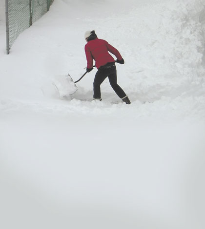
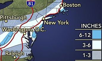
A winter storm system accompanying an incoming arctic cold front is forecast to dump six-to-eight inches of snow on Long Island this week—and up to 10 inches on the South Fork.
A winter storm watch is in effect from noon Tuesday to 6 a.m. Wednesday for Nassau and Suffolk counties, meaning there is a potential for significant snow, sleet or ice accumulations, according to Upton-based National Weather Service meteorologists.
“Snowfall will begin late Tuesday morning and continue into Tuesday night with heaviest snowfall expected Tuesday afternoon and evening,” the agency said in a statement. “Falling, blowing and drifting snow will cause hazardous travel and walking conditions across the [tri-state] area.”
Wind gusts up to 30 mph during the storm are expected to reduce visibility to as low as ¼ mile at times, potentially making for a treacherous Tuesday evening rush-hour commute.
Temperatures in the 20s and teens will drop down to the single digits after sundown, leaving open the possibility of frost bite for those not dressed appropriately.
The return of the arctic air mass known as the polar vortex is expected to follow the storm and likely bring with it subzero wind chills Tuesday into Wednesday, forecasters said.
Temps will stay in the 20s after the storm passes Thursday and Friday and hover in the 30s through next weekend, when the forecast calls for mostly sunny skies.