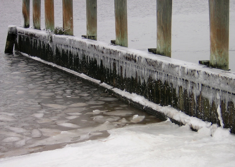
An unwelcome arctic blast hanging over Long Island sent temperatures plunging to record lows Friday morning—and that’s not even counting subzero temperatures generated by flesh-piercing wind chills.
The National Weather Service in Upton said it was 2 degrees at MacArthur Airport in Ronkonkoma around 7 a.m. Monday, shattering the previous record of 10 degrees set in 1993. But it felt much colder than 2 degrees thanks to bone-chilling winds that sent temperatures plunging to as low as 20 below zero overnight. The brutal cold was brought on by a not-so-easy-to-swallow shot of arctic air that enveloped much of the country.
The unbearable temperatures will continue through the day Friday, topping off at 15 degrees. Wind chill values will remain below zero until at least noon, said Nelson Vaz, a meteorologist at the National Weather Service.
The mercury will drop into the single digits again Friday evening. The only good news is that there won’t be much wind, meaning no subzero wind chill temperatures for at least one night.
Don’t celebrate just yet.
Forecasters are tracking a storm that could dump up to 3 inches of snow on the Island Saturday before transitioning into a wintry mix of rain, snow and ice in some areas overnight and on Sunday. The temperature will actually rise during the storm, potentially maxing out at 40 degrees on Sunday, forecasters said.
The relief from bone-numbing temperatures will be short-lived, however.
Another unsavory shot of arctic air will blast LI Sunday night through Tuesday.
The good news: pitchers and catchers have arrived for Spring Training!
Don’t worry, the snow will be gone in 45 days. We think. #ButWhosCounting pic.twitter.com/oYU7fMYSw8
— New York Yankees (@Yankees) February 20, 2015