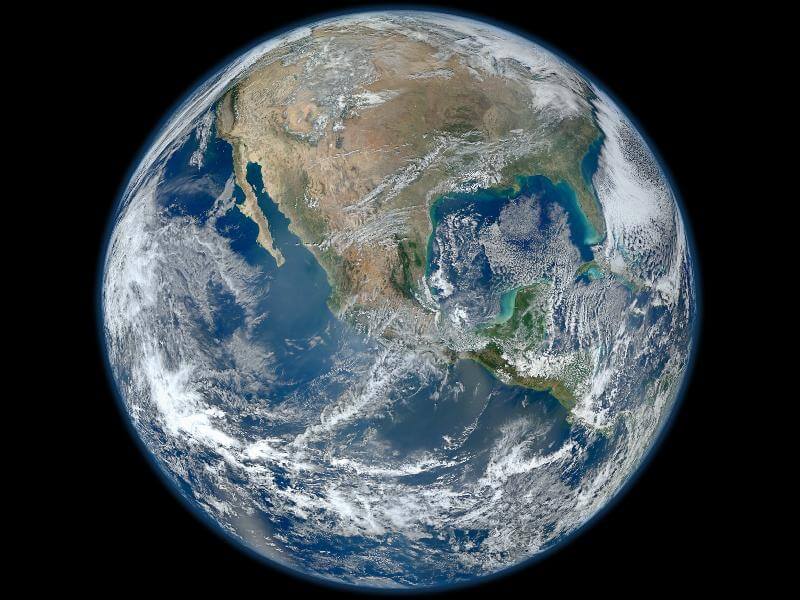
NASA just released a breathtaking image of Earth reviving its nickname “Blue Marble.”
“Blue Marble” was first recorded by Apollo 17’s crew when they photographed Earth upside down during their flight to the moon in 1972.
The photo showing Antarctica, Africa, Madagascar, parts of Asia and the Arabian Peninsula gave Earth’s inhabitants a different appreciation.
“The Apollo Program afforded the world the first views of our fragile planet,” said NASA in a statement. “It was during the Apollo Program that humans witnessed the Earth rise from the blackness of space and got the first ‘full’ view of the Earth.”
“Those images have had a profound impact on humanity, and on ourselves, and prompted the environmental movement in the 1970s.”
The image would be the last, until now, where a human has been at a range that a photo of a whole-Earth could be taken.
This month, once again, 40 years later, an image of a whole-Earth went public. This time, making its way to computer screens around the world is ‘Blue Marble 2012.’
The photo like the last, begs Earthlings everywhere to really take a look and appreciate the beautiful blue planet.
The image is shown in high-definition and unlike it’s predecessor, shows Mexico and parts of North and South America.
According to NASA, the image was taken January 4, from the VIIRS instrument aboard NASA’s most recently launched Earth-observing satellite – Suomi NPP—Suomi NPP is NASA’s next Earth-observing research satellite and is the first of a new generation of satellites that will observe many facets of our changing Earth.
NASA says it was created with a number of swaths of the Earth’s surface.


