
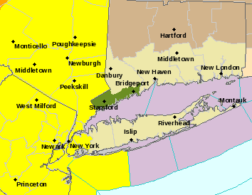
A tornado watch in effect across the New York area through 5 p.m. Monday includes the offshore area south of western Long Island to the Fire Island Inlet.
The tornado watch, which mean the weather conditions are favorable for severe thunderstorms to produce tornadoes, includes New Jersey, upstate New York, Pennsylvania, Delaware and beyond, according to the National Weather Service, which also issued a small craft advisory for boats in waters around LI.
“I strongly encourage all New Yorkers to take extra precautions and stay tuned to local media reports for the latest information on today’s storms,” Gov. Andrew Cuomo said. “Weather conditions can change with little warning, so it is important that New Yorkers take appropriate measures to ensure their preparation and safety throughout severe weather events.”
The tornado watch comes as the forecast calls for a 70-percent chance of thunderstorms that could bring a quarter of an inch of rain or more Monday afternoon.
A severe thunderstorm watch is also in effect for Nassau and Suffolk counties through 10 p.m. Monday.
Showers and windy conditions are expected to continue overnight into Tuesday before clearing up and leaving partly to mostly sunny skies through the weekend, when a slight chance of showers are forecast Friday through Sunday.