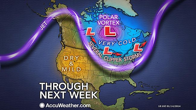
It looks like another arctic blast is right around the corner.
Temperatures on Long Island are forecasted to drop next week when an arctic air mass—the so-called polar vortex—breaks off and barrels toward the region, according to the Upton-based National Weather Service.
The frigid air is predicted to hit LI Tuesday and hang around until Thursday—though it doesn’t appear that temperatures will reach record-breaking levels like it did earlier this month.
The weather service said temperatures will be near freezing Tuesday and will drop into the 20s Wednesday and Thursday.
In the meantime, Long Islanders may have to put up with a few snow showers forecasted Friday evening through Sunday night. The chance of snow for those three days is at or below 50 percent.
The biting cold that enveloped LI earlier this month brought freezing temperatures not felt in four decades. Record lows of 4 and 6 degrees were captured on back-to-back days in Islip.