Well, Long Island had to get one more snowstorm before the weather turns to much more favorable conditions this week.
Another round of snow fell on the Island early Tuesday morning just in time for the morning commute and caused some traffic headaches for many commuters returning to work after a brief three-day President’s Day break.
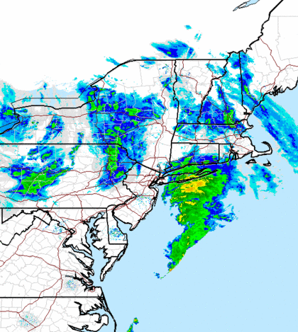
The snow developed around daybreak and continued throughout the morning commute. Forecasters at the National Weather Service said the snow will become moderate by mid-morning and then change over to rain before tapering off later in the day.
The storm—gentler than some of the most recent weather events—is forecasted to drop 1 to 2 inches of snow on Nassau County and 2 to 4 inches in western Suffolk County.
A winter weather advisory is in effect for most of the Island until 6 p.m.
The storm mostly impacted roads in Nassau and western Suffolk, according to the New York State Department of Transportation website, which was reporting snow/ice conditions in those areas.
Commuters traveling on the Long Island Rail Road appeared to be in good shape with the transit system reporting good service on all its branches.
The evening forecast is calling for freezing temperatures around 29, but no snow in the forecast.
Then things will change for the better.
Meteorologists are predicting a high near 45 during the day Wednesday with a chance of rain between 9 a.m. and 3 p.m. Temps will cool down to 31 in the evening.
Thursday should be mostly sunny with temps reaching 46.
Showers are likely Friday, forecasters said, but temperature will be a balmy 54, according to the National Weather Service.
Finally, Long Islanders can expect sunny skies with temps in the 40s this weekend.