With Tropical Storm Hermine threatening to batter Long Island for several days starting Sunday, officials on Long Island urged residents to prepare for the worst and to heed all warnings as the intensifying storm approaches.
Suffolk County Executive Steve Bellone issued a state of emergency Saturday afternoon as the county recommended voluntary evacuations of Fire Island.

“Due to the impending storm, the Village of Ocean Beach would recommend everyone leave Fire Island safely,” Ocean Beach village police said. “Fire Island will have high winds and prolonged flooding conditions.”
The village said residents could expect ferry disruptions associated with the storm. The last ferry to leave Ocean Beach Saturday night will be at 9:40 p.m. Fire Island Ferry, the company that serves the western communities, said service will resume Sunday morning with the potential of service being suspended in the afternoon.
Nassau County Executive Ed Mangano did not say if he intends to issue a state of emergency but he warned residents that storm surges reminiscent of Tropical Storm Irene are possible and 50 mile-per-hour wind gusts could create dangerous conditions.
Residents in low-lying and flood-prone areas should prepare emergency go-kits and make arrangements with family members or friends in the event of an evacuation, he said.
“Be prepared to leave your home,” Mangano said at a press conference at Nassau’s Office of Emergency Management in Bethpage.
“This is not something you go walk around in or go outside if it’s not absolutely necessary,” he added.
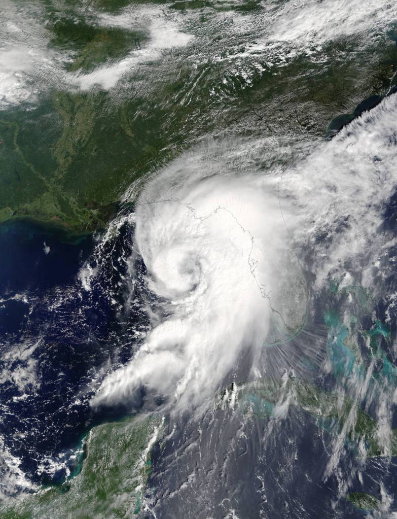
Tropical Storm Hermine is currently churning off North Carolina’s outer banks and is projected to move east into the Atlantic before tracking northward. The massive storm is forecasted to stall in the Atlantic where it’s likely to intensify once it catches the Gulf Stream.
Hermine will still be far south of the Island by Monday but the storm’s bands will start battering the shore in the afternoon. Even so, forecasters at the National Weather Service in Upton said Long Islanders will begin to feel the effects of the storm mid-day Sunday in the form of storm surges up to four feet along the coast.
Along with 50 mph wind gusts and sustained winds of 35 to 45 mph, Hermine is forecasted to dump more than inch of rain on the Island. Rain should start to fall Sunday night and continue through at least Monday. Labor Day could see the heaviest rainfall, the weather service said.
“This storm should be around for quite a while,” said Upton-based National Weather Service meteorologist Jonathan Wolfe.
Here is the latest advisory from the National Hurricane Center on Post-Tropical Storm Hermine. #Hermine pic.twitter.com/6e43rjEKgn
— NWS New York NY (@NWSNewYorkNY) September 3, 2016
Long Island and New York City are under currently under a tropical storm warning.
The weather service said “life-threatening” storm surges could cause flooding and cause damage to buildings, docks, boardwalks and piers along the coast.
Nassau County is readying its shelter at Nassau County Community College in preparation for potential evacuations. Mangano said the county will notify residents when and if the shelter opens.
Residents living in vulnerable areas were urged to review evacuation routes on the county’s website and replenish supplies ahead of the storm.
“Obviously there’s a threat to homeowners” in flood-prone areas, Mangano said.
PSEG Long Island said it has 1,500 line and tree personnel prepared to battle the storm and is coordinating with with up to 700 out-of-state crews.
#DYK what to do during a flood? Retweet & visit our Storm Center for details https://t.co/8onvTdf7Vk #hermine pic.twitter.com/HNWC0i3NQn
— PSEG Long Island (@PSEGLI) September 3, 2016
Hermine has spawned thousands of power outages since it barreled into Florida as a hurricane before being downgraded soon after making landfall.
The weather service is projecting tropical storm conditions until Wednesday.