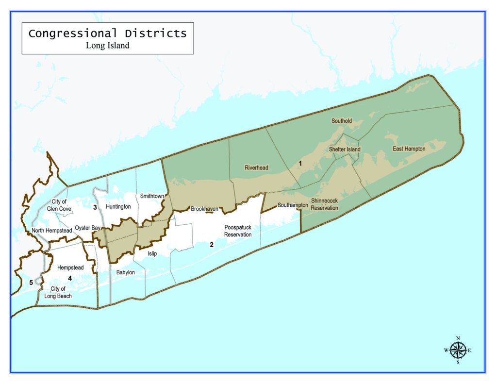
New York’s First Congressional District currently includes all of the five Twin Forks towns and eastern portions of the Town of Brookhaven, including half of Fire Island. Under the proposed new map, southwestern communities in the Town of Southampton were carved out into the Second Congressional District and the First District stretches through parts of the towns of Smithtown, Islip, Babylon, Huntington and — across the county line — a chunk of Oyster Bay.
“Court challenges to the plan, while possible, would be hard to win,” Jeffrey M. Wice, a senior fellow at New York Law School and an expert on redistricting, writes for Dan’s Papers sister publication PoliticsNY.com “Any challenges brought in federal court would be limited to population equality and minority voting rights.”
The state legislature produced the maps last month after the bipartisan Independent Redistricting Commission, made up of an equal number of Democratic and Republican appointees intended to prevent partisan gerrymandering — diluting or packing of voters into certain districts to sway election results — could not agree on a combined map, and punted responsibility to state lawmakers. The Empire State lost one congressional seat, as the census showed its population was smaller than that of other states.
This is the first time in nearly a century that Democrats controlled both chambers of the state Legislature and the governor’s seat during the reapportionment process. State Senate and Assembly district maps are expected to be sent to Gov. Kathy Hochul for her approval next.
The Suffolk County Legislature also must redraw its district lines. Following a court battle, Democrats passed a new map on Dec. 31, hours before the term ran out on the party’s legislative majority. Republicans, who flipped the chamber for the first time in 16 years, are negotiating with Suffolk County Executive Steve Bellone, a Democrat who last week vetoed the map members of his party made, on restarting the process with an independent commission of its own that will host a series of hearings through this fall.
–With Brooklyn Paper
This story first appeared on DansPapers.com.
Sign up for Long Island Press’ email newsletters here. Sign up for home delivery of Long Island Press here. Sign up for discounts by becoming a Long Island Press community partner here.