

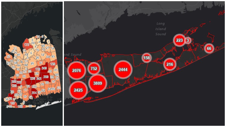
Nassau County, Suffolk County, and New York State have each launched new online mapping tools so the public can track coronavirus cases in their communities and beyond.
The COVID-19 tracker maps all launched within the past week. The state website has a breakdown of statistics locally and beyond LI in addition to assorted other data. The county maps detail the number of cases diagnosed in each community.
The state Department of Health COVID-19 tracker can be found here, Nassau map can be found here, and the Suffolk map can be found here.
Sign up for Long Island Press’ email newsletters here. Sign up for home delivery of Long Island Press here.
Related Story: Long Island Coronavirus Death Toll Tops 500
Related Story: 6 Long Island Hospitals Termed Coronavirus Hot Spots
Related Story: Coronavirus “Like A Fire Spreading” on Long Island, Cuomo Says
Related Story: LI Hospitals See Surge in Coronavirus Patients
Related Story: Coronavirus Causes Blood Shortage; Donors Sought
Related Story: LI Agencies, Hospitals Seek Donations Amid COVID-19 Crisis
Related Story: 3 Things You Can Do For Coronavirus Prevention
Related Story: U.S. Army To Build Temporary Hospitals For Coronavirus Patients In Stony Brook, Old Westbury