
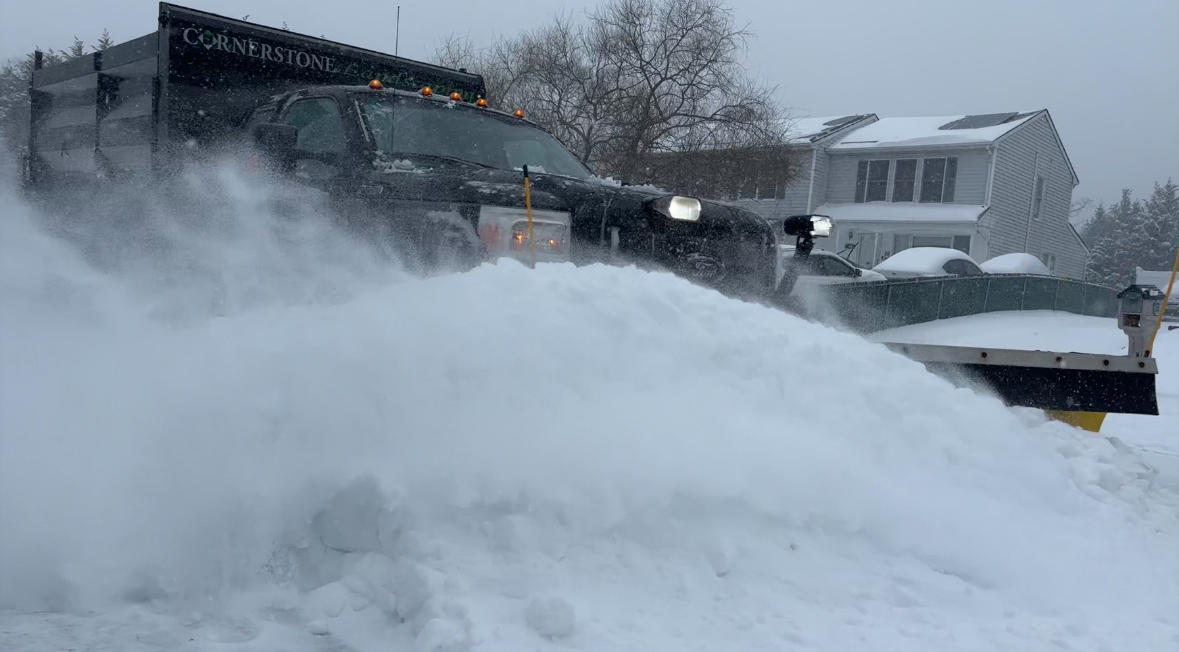
A significant winter storm dumped more than a foot of snow on parts of Long Island on Sunday, causing widespread travel delays and school cancelations Monday amid a cold snap that brought subzero wind chills.
The National Weather Service issued a winter storm warning for Nassau and Suffolk counties through 1 p.m. Monday. A state of emergency was issued for both Nassau and Suffolk counties as well as all of New York State as the snow turned to sleet, creating icy conditions.
“I urge residents to heed the warnings of local officials and stay inside and check on your neighbors,” Suffolk County Executive Ed Romaine said. “As a reminder, please stay off the roads.”
The storm caused power outages and travel delays from Texas to the Northeast. Besides hazardous driving conditions and Long Island Rail Road operating on a weekend schedule Monday, canceled flights also left travelers stranded.
“Reports have indicated that because of travel issues with this storm some stranded travelers are being taken advantage of with price gouging and a lack of accommodations for families who are unable to return home from foreign countries,” Nassau County Executive Bruce Blakeman said. “I am alerting our federal officials and asking that foreign governments are warned to protect our citizens until it is possible for them to return home.”
Gov. Kathy Hochul warned that the snow and wind gusts up to 35 mph could down utility lines and cause power outages.
“We’re not expecting widespread power outages,” she said. “But that being said, it’s always better to be prepared in advance than we have 5,500 linemen and women ready to restore power if necessary.”
The public is urged to bundle up, use portable heaters correctly and not use generators or grills inside — and check on older family, friends, and neighbors.
Upton-based NWS meteorologists released the following snow totals:
Nassau County
Centre Island 15.3"
Levittown 13.1"
East Massapequa 12.2"
Glen Cove 12.1"
North Merrick 12.1"
Seaford 12.1"
Syosset 11.9"
Malverne1 11.3"
Oceanside 11"
Valley Stream1 10.5"
East Meadow 10.4"
East Williston 10.4"
Elmont 10.2"
Bethpage 10"
Farmingdale 10"
Plainview 8.6"
Suffolk County
Setauket 13.5"
Smithtown 13"
Islip Airport 12.9"
Commack 12.8"
Hauppauge 12.5"
North Babylon 12.5"
Orient 12.5"
Sag Harbor 12.2"
East Islip 12"
Mattituck 12"
Mount Sinai 12"
Nesconset 11.9"
East Northport 11.8"
Shirley Airport 11.8"
Central Islip 11.5"
Hauppauge 11.5"
Shinnecock Hills 11.5"
South Huntington 11.5"
Flanders 11.4"
Centerport 11.3"
Babylon 11"
Hampton Bays 11"
Deer Park 10.5"
Poquott 10.1"
Upton (NWS Office) 10"
Stony Brook 9.8"
North Patchogue 9.7"
Center Moriches 8.6"
Sayville 8.5"
Jamesport 7.5"
West Islip 7.3"