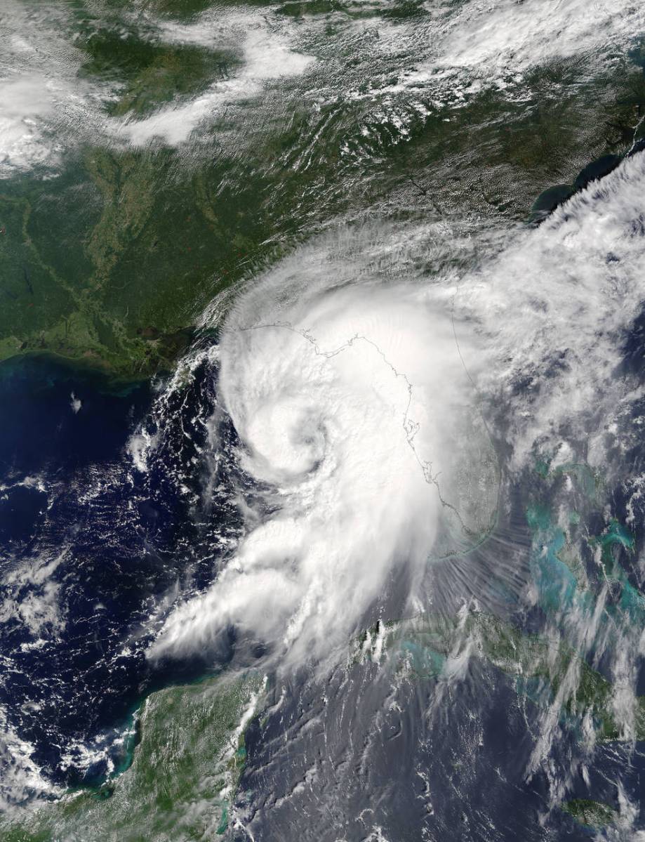
Long Island has been placed under a tropical storm watch as Tropical Storm Hermine threatens to churn up the East Coast and disrupt Labor Day Weekend festivities.
The National Weather Service placed the region under a tropical storm watch at 11 a.m. Friday. The agency issues the alert when sustained winds of 39 to 73 miles per hour or higher are possible.
Although Hermine is currently moving across Florida and into Georgia, Long Island is still in store for strong rip currents and high surf throughout the weekend. Both Nassau and Suffolk counties could experience strong winds late Saturday and then possible coastal flooding Sunday morning, according to the National Weather Service.
“This is our greatest concern,” Suffolk County Executive Steve Bellone said of the possibility that Hermine stalls off the coast of Long Island and creates several days of nor’easter-like weather, which will cause coastal flooding and beach erosion.
“The water can be deceiving,” Suffolk County Police Commissioner Timothy Sini said of the rip currents at oceanfront beaches in advance of the storm.
Bellone said he’ll have a better idea on Saturday on whether the county will order evacuations of flood-prone areas.
Hermine made landfall as a Category 1 hurricane early Friday, but has since been downgraded to a tropical storm.
As of 5 a.m., the National Weather Service said the weakened Hermine’s maximum sustained wind was measured at 70 mph.
The National Hurricane Center said Hermine was moving into southeastern Georgia, bringing with it heavy rain and winds as it glided toward the Carolinas. The massive storm is expected to turn east toward coastal North Carolina Friday evening before heading off the Carolina coast Saturday morning.
If Hermine continues its path, it could batter the Long Island region with tropical storm conditions beginning late Saturday lasting through the middle of next week, the weather service said.
The biggest concern as of now is major coastal flooding as well as heavy rain and strong winds—but that could all change depending on the storm’s track, and if it gains or loses strength as it approaches the region.
Nevertheless, there will be a high risk of rip currents and beach erosion through the weekend and into next week, the weather service said.
Officials have already begun urging residents to prepare for a potential Labor Day weekend storm.
The weather service is forecasting possible tropical storm conditions beginning Sunday night into Tuesday.
“Even if the storm is no longer tropical when it emerges off the Mid-Atlantic coast, the potential for significant impact remains,” the weather service said in its briefing.
The last major tropical storm or hurricane to hit the Island was Hurricane Sandy in 2012.
That was just a year after Tropical Storm Irene slammed the Island in 2011. Irene was downgraded from a hurricane before it made landfall in New York.
Both storms resulted in prolonged power outages and weeks of clean up efforts. In the case of Sandy, some residents are still reeling from the nearly 4-year-old storm.
-With Timothy Bolger
(Featured photo credit: NASA Goddard MODIS Rapid Response Team)
LIVE on #Periscope: NHC Director Dr Rick Knabb https://t.co/tqKWiWUwvJ
— Natl Hurricane Ctr (@NWSNHC) September 2, 2016
A Tropical Storm Watch is now in effect. Stay tuned to https://t.co/xrkkuob9Wl for the latest track on #Hermine pic.twitter.com/OXFZWlKVFP
— NWS New York NY (@NWSNewYorkNY) September 2, 2016


