An arctic blast is bringing dangerously cold temperatures to Long Island and experts are urging residents to take proper precautions.
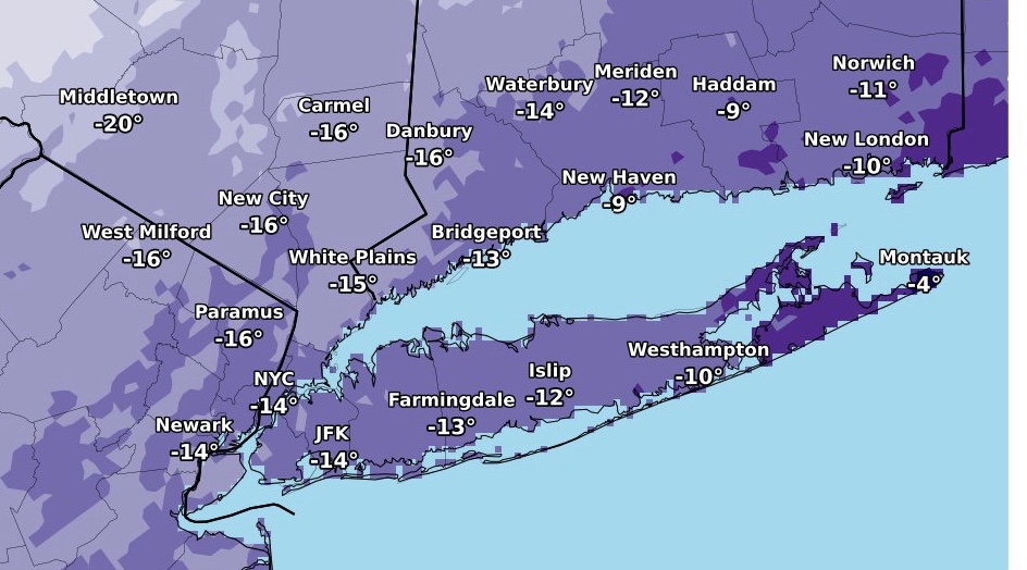
The National Weather Service issued a wind chill advisory for Wednesday night into Thursday morning, when wind chills could make it feel as cold as 15 below zero in parts of the region. NWS also issued a wind advisory warning of gusts up to 50 mph Wednesday evening that could blow down limbs, trees, and power lines, causing scattered power outages. And in a special weather statement, the agency warned of black ice on the roads Wednesday morning that could make driving hazardous.
“The cold wind chills could cause frostbite on exposed skin if precautions are not taken,” Upton-based NWS forecasters said in the wind chill advisory, which means that cold air and the wind will combine to create low wind chills. “Make sure you wear a hat and gloves.”
The advisories come as much of the nation is facing a similarly deep freeze.
In addition to the cold, snow squalls are possible Wednesday afternoon, although there is not expected to be any accumulation.
“Morning sunshine will give way to increasing clouds as an arctic cold front approaches the region,” NWS said. “The front is likely to bring a period of snow showers or snow squalls to the region this afternoon, along with strong gusty winds. While not every location will receive snow, those that do will experience a rapid drop in visibility and a quick coating of accumulation.”