
Near-blizzard conditions of heavy snow and 35 mph wind gusts are forecast to hit eastern Long Island on Monday, causing blackouts, reducing visibility to 1/4 mile and a sloppy commute.
Four to eight inches of snow are expected to blanket Suffolk County and forecasters predicted two to four inches in Nassau County, according to the National Weather Service (NWS).
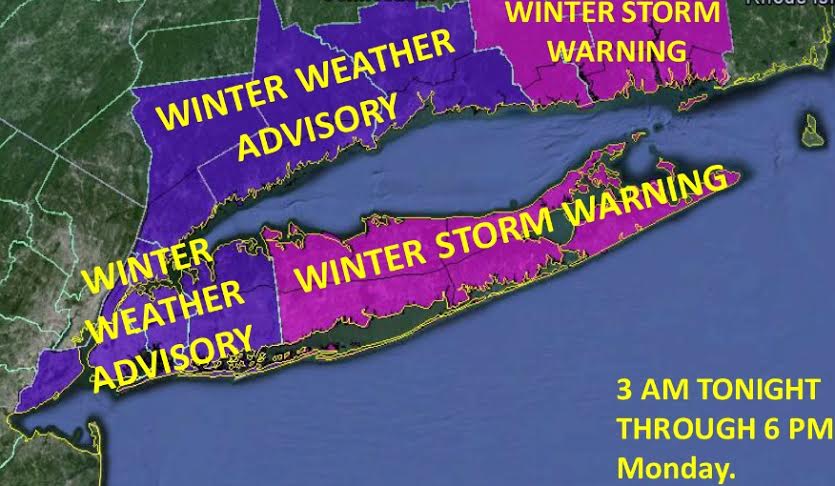
“The heaviest snow will fall from the Monday morning commute through Monday afternoon,” NWS said in a winter storm warning issued for Suffolk from 3 a.m. to 6 p.m. Monday.
NWS issued winter weather advisory for Nassau for the same time period. A high surf advisory was also issued from 1 a.m. Monday to 7 a.m. Tuesday due to large, erosion-causing waves on the ocean beaches. And a coastal flood advisory was issued due to high tides up to 2 1/2 feet above normal on both the south shore and the north shore, flooding low-lying areas.
The same storm is expected to cause the same headaches for much of the tri-state area.
Although the accumulation is expected to be less, the storm otherwise appears to be a repeat of the storm that hit Friday, when wet, heavy snow resulted in hundreds of school closures, thousands of power outages and countless travel delays.
Once this storm clears, more snow is forecast for Tuesday. A chance of light snow is also expected Wednesday and Thursday before clearing up Friday.