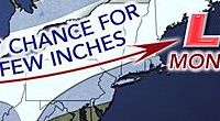
Another storm is forecast to bring one-to-two inches of snow Saturday to Long Island during the arctic blast that made ice of the white stuff that fell earlier this week.
The quick-moving frontal system will potentially cause brief periods of moderate-to-heavy snow banding or snow squalls Saturday afternoon, according to Upton-based National Weather Service meteorologists.
“Hazardous travel conditions are likely as any heavier snow combined with moderately strong winds will significantly reduce visibilities,” the agency said in a statement. “Untreated and elevated roads will [become] rapidly snow covered due to the frozen ground.”
The flakes are forecast to start falling around 11 a.m. Saturday and continue through 2 p.m. with temperatures in the low 30s and wind gusts of up to 38 mph feeding the subzero wind chills caused by the polar vortex.
A coating of snow is generally expected across the region with higher amounts north and west of the city.
Sunday is expected to be mostly sunny and breezy in the 20s with a 30-percent chance of light snow after 9 p.m. that continues through Monday morning. Tuesday will be sunny in the teens before another chance of snow moves in Wednesday.