

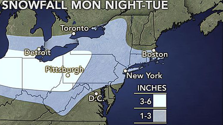
A fast-moving winter storm that is forecast to bring up to three inches of snow, high winds and frigid temperatures to Long Island may snarl the Tuesday evening rush hour commute.
Snowfall is predicted for Nassau and Suffolk counties from 11 a.m. to 5 p.m. Tuesday, with accumulations of as little as an inch possible, according to the National Weather Service. Wind chills will make temperatures in the 40s on Monday will feel like the 20s—with wind chills likely to be in the single digits after nightfall.
“Light snow will…overspread the area on Tuesday as a weak low tracks south of Long Island,” the agency’s Upton-based meteorologists said in a statement. “Some minor accumulations can be expected. It will be a cold day with highs in the teens and 20s.”
The storm is also expected to dump up to a half a foot of snow on parts of the Midwest before passing over the tri-state area and heading out to sea, leaving bitterly cold temps in its wake.
A slight chance of snow showers is expected to linger into Wednesday, when gusts may reach nearly 40 mph and temps are likely to remain in the 20s. Another slight chance of snow showers are expected Thursday as temps continue dropping into the teens overnight.
Sunny skies are on tap for next weekend as temps warm up slightly into the low 30s.