Old Man Winter apparently has no sense of time.
With a week until spring, Mother Nature has decided to threaten Long Island with the most powerful winter storm of the season—a major nor’easter that could dump upwards of two feet of snow on parts of the Island.
The latest update from the National Weather Service’s Upton office says LI could see anywhere from 12-24 inches of snow, a slight upgrade from an earlier forecast that called for 20 inches.
Earlier on Monday the weather service issued a blizzard warning for most of Long Island, excluding the East End, which will go into effect midnight Monday and last 24 hours. Eastern Suffolk County is under a winter storm warning but could still face more than a foot of snow.
Gov. Andrew Cuomo took the precautionary step of declaring a state of emergency across all of New York. Cuomo ordered that the MTA suspend express subway service after Monday evening’s rush hour commute in order to store trains underground. Warning of future disruptions, Cuomo urged Long Island Rail Road commuters to avoid using the system on Tuesday.
“With heavy snow and blizzard-like conditions expected from upstate to downstate, we are taking every precaution to keep New Yorkers safe,” Cuomo said.
If the storm stays on track, it should enter the region after midnight Monday and pick up steam Tuesday morning, forecasters said. The storm could be at its most dangerous from the morning into the afternoon, with forecasters predicting snowfall rates of 2 to 3 inches per hour.
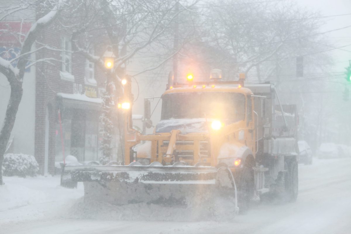
The blizzard could make traveling dangerous due to whiteout conditions. Aside from rapidly falling snow, Long Islanders may have to contend with powerful wind gusts of up to 55 miles per hour, forecasters said. Local utilities were issuing warnings early Monday about the potential for power outages from the severe storm.
And that’s not all. The South Shore could be in for a beating. A coastal flood warning was issued from 8 a.m. until 2 p.m. Tuesday for those communities, as moderate coastal flooding is expected around high tide.
The late winter storm is threatening millions of Americans along the East Coast. Hundreds of flights have already been cancelled.
“The airlines are currently in the process of adjusting their flight schedules in advance of tomorrow’s storm,” Long Island MacArthur Airport reported. “Travelers are advised to check with their air carrier for the most updated information on delays and/or cancellations.”
Officials on Long Island took to the cameras Monday to urge residents to stay off the roads, as the early predictions do not bode well for the Island. In preparation, officials have already instructed crews to treat roads before the white stuff begins accumulating and are mobilizing workers in advance of the storm. In past blizzards, the biggest obstacle to attacking snow-covered roadways is the blowing wind, which makes navigating sleek roads difficult for plow operators.
For the region, this severe winter weather, which could be the strongest storm of the season, comes after one of the warmest Februaries on record.