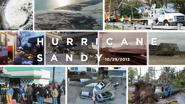
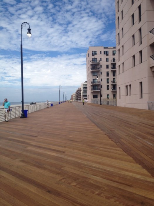
Clockwise from top left: A radar image of Superstorm Sandy, an aerial view of the breach in Fire Island dubbed “New Inlet,” LIPA crews working to get the lights back on, a house on Fire Island that fell off of its pilings, one of the many felled trees, cars buried in sand in the streets of Long Beach, gas lines that extended for hours and blocks, and Red Cross volunteers helping survivors at Cedar Creek County Park in Seaford. Center from left: the splintered Long Beach boardwalk and a boat that floated onto the Long Island Rail Road tracks.
Saturday marks 10 years since Superstorm Sandy caused catastrophic damage to Long Island, destroying dozens of homes, leaving most residents without power, breaching barrier islands and incapacitating a sewage treatment plant.
News, events, culture and more — delivered to you.
Thank you for subscribing!
Sandy rolled ashore Oct. 29, 2012, killing 153 people, including 53 in New York—13 of them on LI. Millions were displaced across the East Coast, with about 40,000 in The Empire State. Causing an estimated $65 billion in damage, the storm is the sixth costliest on record—down from second.
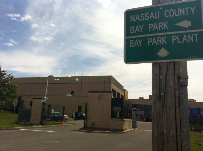
The Bay Park Sewage Treatment Plant, which was knocked offline for a month after the storm, spewing sewage into waterways and homes, has been reconstructed. Waterfront neighborhoods that were flooded in the storm surge have changed dramatically, such as the shuttering of Long Beach Medical Center. And questions linger about how transparent federal agencies have been while allocating the $50 billion recovery aid package.
Some of the money was allocated to fund workers to finally start in December 2021 a long-stalled $1.7 billion federal project to mitigate storm damage from the South Fork to Fire Island, more than a half century after the idea was proposed.
Here are 10 photos that captured the devastation.
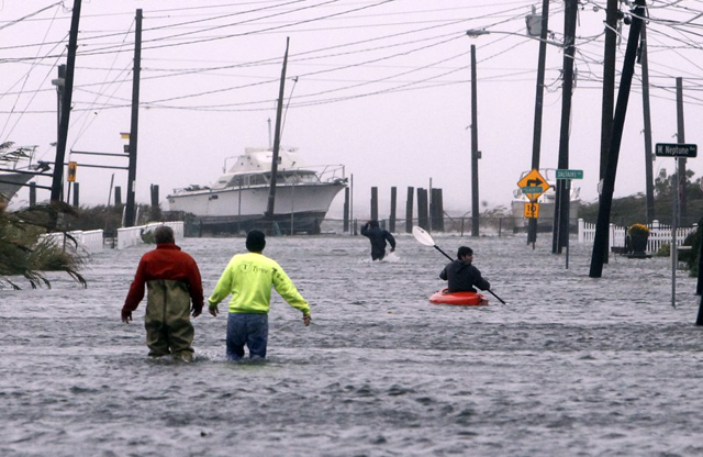
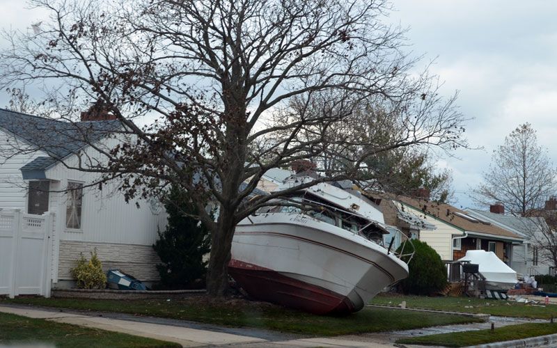
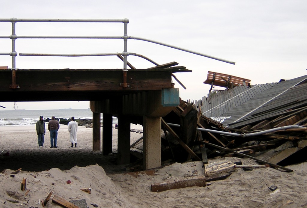
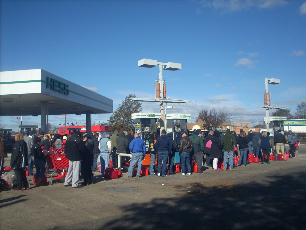
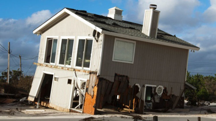
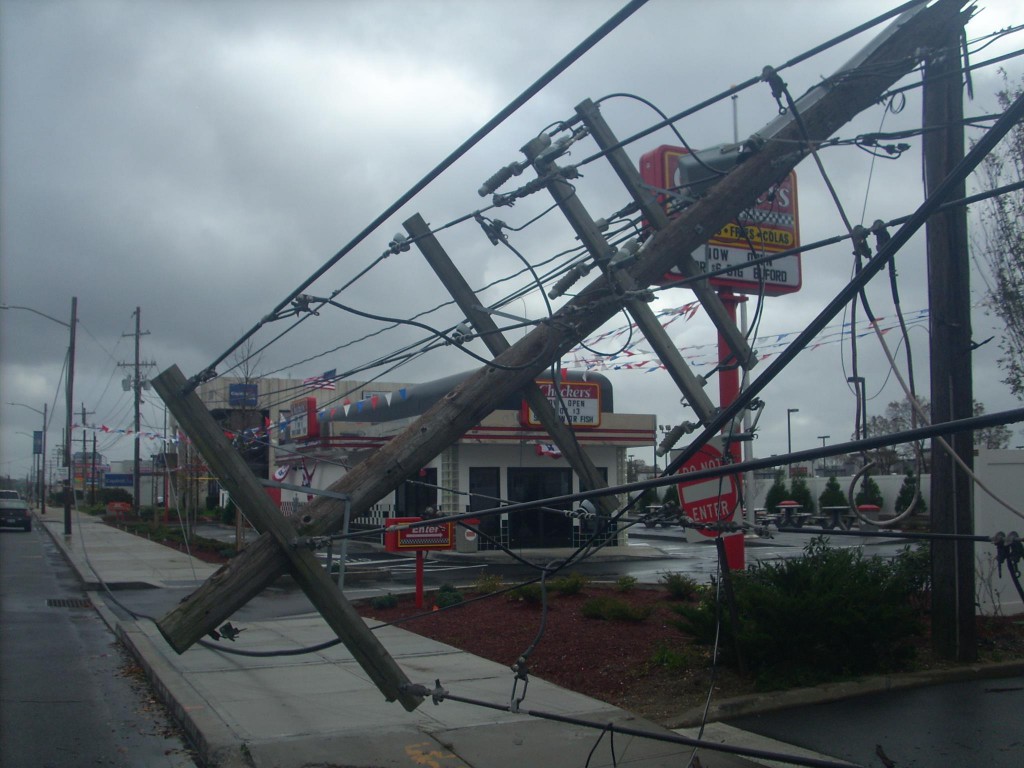
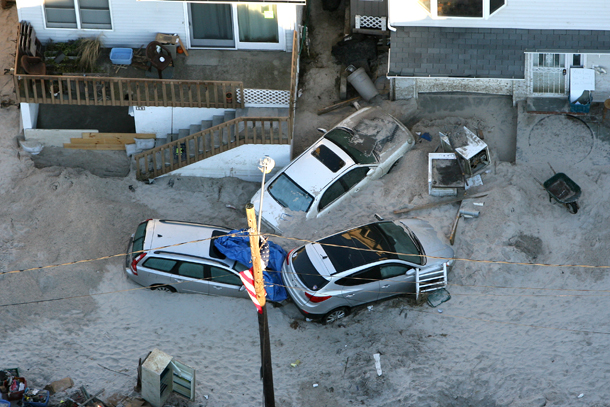
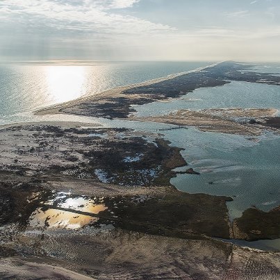
A satellite image of Sandy on its way up the East Coast before it made landfall in New Jersey on Oct. 29, 2012. (NOAA)Lindenhurst was among the worst flooded areas on LI after Superstorm Sandy (Photo by Jason DeCrow)This scene of a boat in a yard in South Freeport is just one example of the sheer destruction Hurricane Sandy unleashed on Long Island. (Michael Conforti/Long Island Press)The Long Beach boardwalk was among the many structural casualties of Superstorm Sandy. (Photo by Joe Abate)Hundreds of people swarmed a Hess gas station on Sunrise Highway in Lindenhurst on foot and by car Saturday, Nov. 3, 2012 to get as much fuel as they could as temperatures continued to drop and more than 700,000 residents remained without heat or electricity one week after Hurricane Sandy wreaked devastation across the Northeast. It was a familiar scene across Long Island. (Christopher Twarowski / Long Island Press)Some homes, like this one swept off of its foundation on Fire Island, were total losses after Sandy (Timothy Bolger/Long Island Press.)Downed telephone and power lines, such as these on Sunrise Highway in Massapequa, were a common scene following Hurricane Sandy. (Christopher Twarowski/Long Island Press)Cars were buried in sand last October when Hurricane Sandy struck Long Beach. (Kevin Kane/Long Island Press)The breach on Fire Island at Old Inlet was one of three opened by Superstorm Sandy and the only one left open. One of the other breaches was also on FI, at Smith Point, and the other was at Cupsogue Beach in Westhampton. (FINS).Residents of some communities devastated by Hurricane Sandy took to warning potential looters targeting affected and abandoned homes. (Christopher Twarowski / Long Island Press)