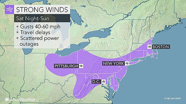
Spring may have sprung, but the forecast for Long Island is unseasonably cold with snow likely through Tuesday and strong winds expected to down trees, causing power outages over the weekend.
Showers on Saturday are likely to change from rain to snow overnight into Sunday, when wind gusts up to 60 mph are forecast for the region—with the chance of rain and snow continuing Monday into Tuesday, although little to no accumulation is expected, according to the National Weather Service (NWS).
“Trees and power lines may be downed,” Upton-based NWS meteorologists said in a high wind watch that’s in effect from midnight to noon Sunday. “This may lead to scattered power outages [and] difficulty driving high-profile vehicles.”
PSEG Long Island is anticipating possible widespread outages as a result of what the utility described as “extreme winds.” Crews are performing system and logistics checks to prepare.
“If weather forecasts are correct, we could experience significant damage to the trees and power lines across our service territory due to the strong, gusting wind,” said John O’Connell, vice president of transmission and distribution at PSEG Long Island. “Our crews stand at the ready to begin restoring service, in the event of any outages, as safely and quickly as conditions allow. We ask that customers be patient.”
Temperatures in the 50s on Saturday will drop into the 30s after sundown and temps will drop into the 40s on Sunday, with the trend continuing through early next week until the skies are forecast to clear up on Wednesday.