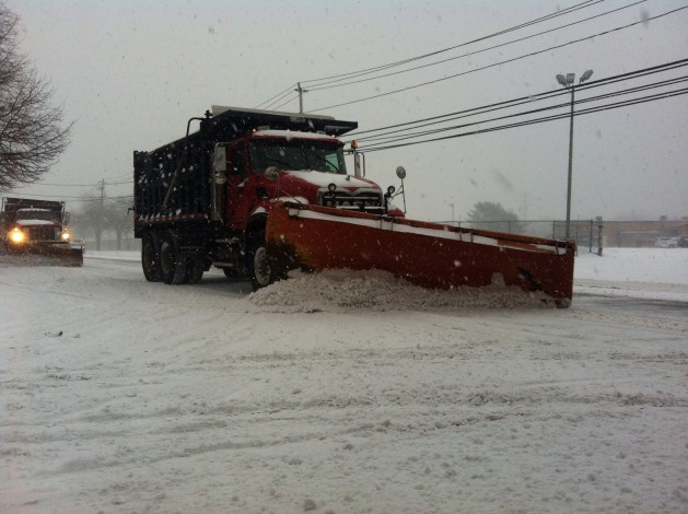
The forecast for the winter storm expected to hit Long Island on Thursday has worsened again, with more than a foot of snow now expected in some areas bracing for blizzard conditions.
Ten to 14 inches of heavy snow is forecast for Suffolk County, which will be under a blizzard warning from 3 a.m. to 6 p.m. Thursday, according to meteorologists in the Upton office of the National Weather Service (NWS). Nassau County remains under a winter storm warning from midnight to 6 p.m. Thursday, but it’s now expected to see eight to 12 inches of snow. Winds are expected to reach 30 mph with up to 45 mph gusts as temperatures drop into the 20s overnight.
“Local power outages with downed trees and power lines possible,” the NWS said in the blizzard warning. PSEG Long Island has said that it is preparing for power outages.
A blizzard warning means that heavy snow and strong winds will significantly reduce visibility. Much of the New York Metro area is also under a winter storm warning.
Forecasters warned drivers to stay off the roads, except in case of emergency. For those that must travel, drivers are urged to carry a survival kit, including a flashlight, food and water in case they get stranded.
Nassau officials said county road crews have begun pre-treating roadways with brine to prevent black ice from forming. Suffolk official will discuss their storm preparations at a news conference scheduled for Wednesday evening.
Forecasters had initially said Monday that the storm would bring up to six inches of snow, but the projected accumulations were upped to 10 inches on Tuesday before being increased again in the final hours before the storm hit.
Once the storm clears, Friday is forecast as cloudy with wind chills between zero and 10 and another chance of light snow after sundown, NWS said.