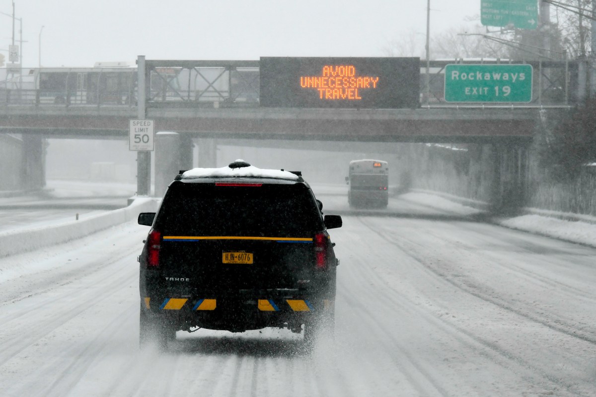
Long Island may have been spared the worst of the monstrous nor’easter whopping the East Coast but the wintry mix, strong wind gusts and impending plunging temperatures won’t make for a fun evening or, for that matter, a generally comfortable commute for those heading home.
As day transitions to night on Long Island, residents can expect rain and breezy conditions with gusts of more than 30 miles per hour. Meanwhile, the temperature will drop to a low of 21, with the wind chill between 10 and 20 degrees, forecasters said.
Officials throughout the day urged residents not to take the storm lightly, as the wintry mix that characterized most of the storm could transform into black ice. The message: Don’t be fooled by passable roads.
“The snow has actually turned into more of a sleet and rain and that is expected to continue throughout the day and into the evening,” Gov. Andrew Cuomo said during a stopover in Dix Hills.
“That does not mean that it is safe to go out,” he continued. “The roads are very, very nasty and the roads are very dangerous. We are still clearing the roads, many of them are filled with sleet and slush and it is very important for us to get the roads cleaned before the weather drops tonight and that slush freezes.”
The consensus among officials Tuesday was that tightly packed slush creates less-favorable conditions than even more than a foot of snow. The concern is that the mixture of sleet, ice, and freezing rain could convert into all ice as the temperature drops, thus forming sheets of black ice.
Their concerns notwithstanding, officials expressed relief that predictions of blizzard conditions did not manifest.
“I for one am very happy when we have the occasional storm that comes in a little less than predicted and that’s what we’ve had here,” said Suffolk County Executive Steve Bellone. “We talked all day yesterday about the fact that we are on the edge of the storm here. Predictions up to 18, even two feet in some areas but this is what happens with the weather, it can shift, and we saw that happen here and the accumulations here were less than predicted just yesterday.”
Nassau County Executive Ed Mangano noted how the Island “dodged the blizzard bullet,” while urging residents not to be deceived by the unimpressive snowfall.
“We’re fighting sleet, dropping temperatures, black ice,” said Mangano, who in October pleaded not guilty to bribery charges. “And those are the major concerns. There’s been a number of accidents in Nassau County.”
With numbers coming in from the Long Island Rail Road Tuesday, it appeared as if commuters heeded warnings to stay home. Ridership was only at 15 percent of what it usually is during the week, officials said. Despite the sustained wintry mix falling over the region, the LIRR operated Tuesday mostly close to schedule.
Later in the day, however, the LIRR was experiencing some weather-related cancellations and limited delays on at least two branches.
The storm impacted a large swath of the East Coast, knocking out power to thousands and paralyzing airports.
PSEG Long Island said more than 3,000 people were without power in the late afternoon.
Almost all flights were cancelled out of LaGuardia Airport Tuesday, and John F. Kennedy Airport saw two-thirds of its flights cancelled, with that number climbing.
Long Island and New York City escaped the worst of the storm’s wrath as it made a westward shift in the early morning.
The storm comes within less than a week left of winter and off the third-warmest February on record.
Mangano joked earlier in the day about the wild winter: 60 degrees one day, he said, and a winter storm the next.
“You know, extreme weather is a new reality,” said Cuomo. “My father was governor for 12 years. I’ve been governor for about six years. I’ve had twice the number of federal disasters than my father had in one half the time.”
(Photo credit: NY Governor’s office)