


Get home early and stay indoors.
That was the message relayed from both government and transportation officials to Long Islanders as a strong winter storm barreled into the area early Tuesday afternoon, wreaking havoc on major roadways and snarling traffic across the Island.
As the storm was fast approaching, Suffolk County Executive Steve Bellone declared a state of emergency and urged drivers to stay off the roads.
Nassau County Executive Ed Mangano asked residents to heed warnings from forecasters who were predicting “near blizzard like conditions” throughout the afternoon and evening.
“This will make the evening commute treacherous,” Mangano said. “So we urge residents that can leave work a little early to do so and those that are already home to stay home.”
New York Gov. Andrew Cuomo declared a state of emergency for Nassau and Suffolk and warned of a “one-two punch” of snow and bone-chilling cold.
“I urge all those in the affected regions to exercise caution, and avoid travel if possible,” Cuomo said. “State resources are deployed to clear snow and help those impacted by the storm, but above all it is important that New Yorkers remain safe both during and after the storm.”
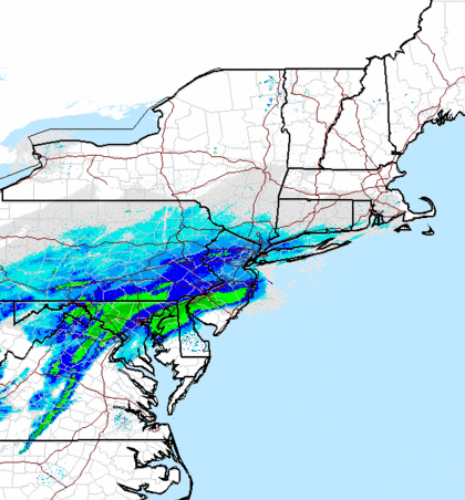
A winter storm warning remains in effect for both counties until 6 a.m. Wednesday.
The Upton-based National Weather Service at 4 p.m. Tuesday dropped its projected snowfall totals from 10 to 14 inches to 8 to 12.
Forecasters also warned that the worst is yet to come.
Tim Morrin, a National Weather Service meteorologist, said the coastal storm will be at its “absolute worst” between 7 p.m. and 4 a.m.
Light snowfall began falling Tuesday morning, but wasn’t a major factor during the morning commute.
Things quickly changed around lunch time.
The Long Island Rail Road, which was reporting minor weather-related delays on four of its branches, urged riders to leave work early because the storm arrived earlier than expected.
Traffic on major roads moved at a snails pace due to snow quickly accumulating on roadways.
The storm also forced Long Island MacArthur Airport to cancel all flights after 3:15 p.m.
All commercial #flights scheduled after 3:15 today have been cancelled. #Travelers advised to check with carrier for latest info. #Airlines
— LI MacArthur Airport (@LIMacArthur) January 21, 2014
Mangano said at a press conference Tuesday afternoon that public works employees began treating roadways at 5 a.m. in a preemptive strike to prevent black ice. He said more than 200 employees will be battling the storm, adding that the county had more than 100 assets, including plows and spreaders, out in the streets. The county also has on hand more than 13,000 tons of salt.
Suffolk officials said the county had a fleet of more than 300 vehicles working on snow removal and spreading salt across county roads. The county has in stock between 16,000 to 18,000 tons of salt and sand, a county spokeswoman said.
“The roads can be treacherous due to the snow accumulations as well as the freezing conditions,” she said. “We want people to be very careful as they’re traveling on the roads.”
The county also announced that its bus system, Suffolk County Transit, will cease operations at 6 p.m. Tuesday and will start up again at 8 a.m. Wednesday.
The cold is also expected to be a factor because of an arctic air mass that moved into the region. The arctic air mass, which breaks off and travels south, should send temperatures plunging into the teens. Forecasters also warned that strong sustained winds and gusts topping 35 mph could produce a wind chill of 10 degrees below zero.
Tell us on Facebook: