
The groundhogs were right: Wintry weather isn’t done with us yet.
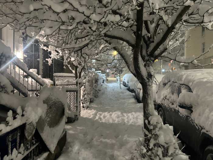
All eyes on yet another snowstorm — this time the first blizzard in a decade — expected to blanket parts of Long Island in more than two feet of snow this weekend, forecasters say.
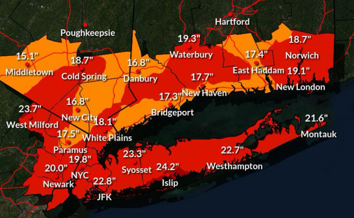
The National Weather Service issued a blizzard warning for Nassau and Suffolk counties from 1 p.m. Sunday through 6 p.m. Monday, when snow accumulations of 16 to 24 inches and wind gusts up to 70 mph may hit the East End, reducing visibility to a 1/4 mile. There is a 10% chance it could reach 33 inches in some areas. The agency also issued a coastal flood watch for waterfront areas.
“Whiteout conditions are expected and will make travel treacherous and potentially life-threatening,” Upton-based NWS meteorologists said in the warning statement. “The strong winds and weight of snow on tree limbs may down power lines and could cause sporadic power outages. Travel could be very difficult to impossible.”
Much of the tristate area is under the same blizzard warning, which comes as snow and ice has yet to fully melt from the last snowstorm dumped over a foot of snow on the area on Jan. 25 before a deep freeze settled in, keeping the accumulation from melting. AccuWeather reported that the accumulations this time would be higher on the East End.
Nassau and Suffolk counties are under a travel ban beginning 9 p.m. Sunday through 9 a.m. Monday., with the exception of essential workers and plow operators. Many school district across Nassau and Suffolk counties canceled classes for Monday. Flights were canceled and the Long Island Rail Road pre-emptively suspended service beginning at 1 a.m. Monday.
PSEG Long Island warned that wind gusts could be “strong enough to potentially topple trees, bring down branches on wires and cause outages.” The utility said it has “personnel ready to respond safely and as quickly as possible throughout the storm.”
Gov. Kathy Hochul issued a state of emergency, as did many local municipalities, in advance of the blizzard’s arrival.
“New Yorkers are no strangers to snow and cold weather, but these blizzard-like conditions … will bring heavy snow and strong winds, with the storm forecasted to impact much of our state,” the governor said. “As with every weather event, our state agencies are equipped with the resources they need to respond to the developing storm and keep everyone informed. I encourage everyone to take action, stay vigilant and always monitor your local forecast for real-time updates.”
The flood watch pertains to low-lying shoreline areas that forecasters say could see inundation up to 2 ½ to 3 feet above ground level Sunday evening through late Sunday night.
“This would result in numerous road closures and cause widespread flooding of low-lying property including parking lots, parks, lawns and homes/businesses with basements near the waterfront,” NWS stated. “Vehicles parked in vulnerable areas near the waterfront will likely become flooded. Flooding will also extend inland from the waterfront along tidal rivers and bays. Ice cover in the bays and harbors could exacerbate flooding and cause damage to northeast to east facing shoreline structures.”
Beach and dune erosion, especially at high tide, are likely, with possible wash overs in compromised dune areas.
“This water level forecast has been leaned towards a high-end scenario, providing a margin of safety,” the agency added. “It is highly dependent on timing of windshift from northeast to north storm force winds with respect to the time of high tide. If shift to northerly winds occurs earlier than time of high tide, water levels will fall to the low end or even below the forecast range. Ice cover in the bays and harbors could exacerbate flooding and cause damage to north to northeast facing shoreline structures. Additional minor to locally moderate coastal flooding is likely with the Monday afternoon high tide.”
Related story: Guide to Long Island’s Coolest Sledding Spots
Send snow photos to letters@longislandpress.com