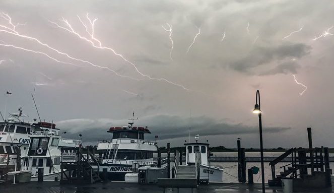
Another round of strong thunderstorms caused wind damage, flooding, road closures, and power outages on Long Island Monday night into Tuesday morning.
The highest wind gust on LI was recorded at 65 mph in West Gilgo Beach, according to the National Weather Service (NWS). More than 25,000 of PSEG Long Island’s 1.1 million customers lost power in the storm. More than 800 tree and line restoration personnel were deployed to make repairs.
“Crews worked through the night and will continue to work 16-hour shifts to assess damage and make repairs,” the utility said in a statement, noting that most customers had power restored by Tuesday morning. About 1,000 customers were still without power Tuesday afternoon.
Nassau County saw the highest amount of rainfall in the tristate area with 3.94 inches recorded shortly before 9 a.m. in Syosset, with peak rain fall in Suffolk County hitting 3.06 inches in Northport, NWS said.
The many reports of flash flooding included all lanes of the eastbound side of Belt Parkway being closed near Cross Island Parkway shortly before 9 a.m., a car stuck in floodwaters on James Street in Garden City around 9 p.m. Monday, and Crabapple Road in Flower Hill temporarily being closed due to flooding around the same time, NWS reported.
Wind damage was reported to have downed a tree on a house in Ronkonkoma, another tree falling on a house in Shirley, and another across the Long Island Rail Road tracks in Speonk, NWS said.
Downed trees were also reported to be blocking Bernice Drive in East Meadow, Brookhaven Road in Upton, and Revilo Road in Shirley.
Once a 50-percent chance of rain passes Tuesday, the forecast for the rest of the week and next weekend is sunny with temperatures in the 80s.