
This week, NASA released stunning photos of the Atlantic Ocean as they have done in previous weeks but this time, three different storm systems are visible.
Newborn Tropical Storm Maria, the 13th named storm of the 2011 hurricane season, joined Hurricane Katia in the Atlantic Ocean this week and both storms could be seen from the GOES-13 satellite.
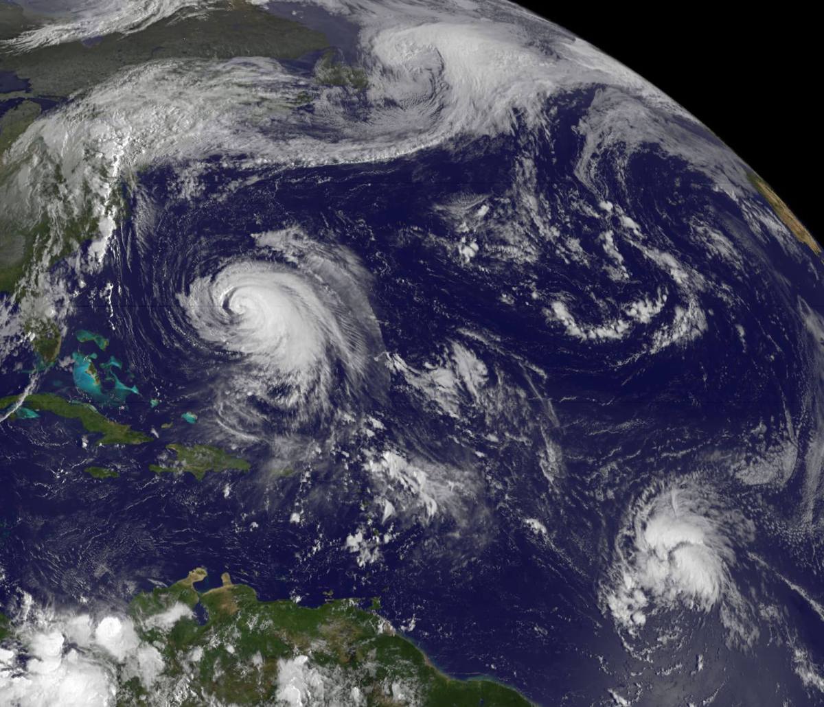
In the photo, taken September 7, Hurricane Katia, a Category 1 storm, can be seen moving North between Bermuda and the United States. So far, Hurricane Katia has prompted a tropical storm watch for Bermuda but is not forecasted to come ashore anywhere on the East Coast.
Tropical Storm Maria is seen between Africa and the Lesser Antilles. According to NASA, Maria is located about 1305 miles east of the Lesser Antilles. Meteorologists are also keeping an eye on Tropical Storm Maria, who has sustained winds of 50 MPH, but say it’s too soon to determine whether or not Maria will be a threat to any land.
The photo also shows remnants of Tropical Storm Lee over the East Coast. Lee hit the Gulf Coast last week but has traveled east bringing with it rain.
Read about wet weather, strong surf, rip currents continuing for Long Island.