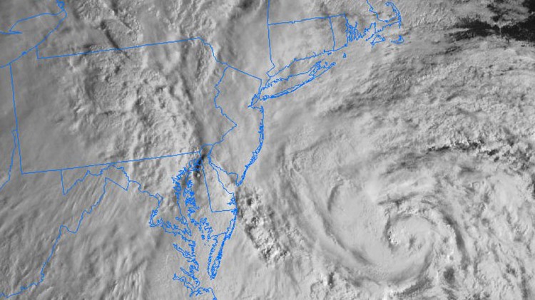
National Weather Service forecasters warned that although they predict the 2014 Atlantic Hurricane Season starting next month will be normal, coastal residents remain at risk for a potential big storm like Sandy.
Officials urged residents of the East Coast, including Long Island, to prepare for the worst and not be lulled into complacency by the “near or below normal” outlook for the hurricane season, which starts June 1 and ends Nov 30. The season peaks in September.
“It only takes one destructive storm to make for a very bad season,” Kathryn Sullivan, administrator of the National Oceanic and Atmospheric Administration (NOAA), told reporters during a news conference Thursday. “Whatever the probabilities are, one storm can wreak tremendous havoc.”
The agency’s meteorologists predicted eight to 13 tropical cyclones, three to six of which may strengthen into hurricanes, with one or two of those reaching major hurricane status—a category-three storm with 111-129 mph sustained winds capable of snapping trees and devastating homes.
Experts said that several factors are at play in their seasonal forecast. While the Atlantic is in the midst of a hurricane-prone part of a multi-decadal cycle, the sea-surface warming weather pattern known as El Niño is expected to suppress tropical cyclones from gaining wind speed. They noted that the outlook is of expected hurricane activity, not the impact of predicted storms.
That’s why Federal Emergency Management Agency (FEMA) officials joined forecasters at the press conference to remind residents of hurricane-prone areas that they should heed the lessons of Sandy to have a plan, pack essentials and not ignore orders to evacuate their homes.
“There should be no one that doesn’t understand if they’re in a danger zone,” said Joseph Nimmich, FEMA associate administrator for Response and Recovery. “There is not one of us that can withstand the surge and protect their house when it is under attack by nature.”
While hurricane categories rank storms on wind speed, it is often the storm surge—hurricanes causing ocean water to rush over land—that claims the most lives. To help local officials and residents better prepare for storm surges, the National Hurricane Center will create the first-ever Potential Storm Surge Flooding Map warning maps this season.
“During Sandy, Staten Island, Rockaway and the South Shore of Long Island were slammed with a storm surge that had all the power and fatal results of a tsunami,” U.S. Sen. Charles Schumer (D-NY) said in a news release announcing the new maps. “We all saw the devastating impact a storm surge can have, which is why these new storm surge maps and warning systems that highlight the life-threatening risk of remaining within these vulnerable areas during a storm are so essential.”


