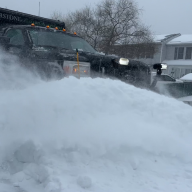


A winter storm blanketed parts of Long Island in up to eight inches of snow over the last weekend of 2025.
The National Weather Service had predicted up to a foot of snow for Nassau and Suffolk counties overnight Dec. 26 into Dec. 27. Gov. Kathy Hochul issued a state of emergency for the downstate region and Nassau County Executive Bruce Blakeman made the declaration for the county.
“Roads, and especially bridges and overpasses, will likely become slick and hazardous.,” NWS stated in winter storm warning. “Travel could be very difficult.”
An overnight storm Sunday into Monday as temps reach the high 40s is expected to wash away some of the snow.
Here are the snow totals, according to NWS:
NASSAU
Farmingdale: 5 inches
Syosset: 4.6 inches
Malverne 4.1 inches
Massapequa Park 4.1 inches
Massapequa 4.1 inches
Centre Island 4 inches
Bellmore 4 inches
Plainview 3.5 inches
Elmont 3.5 inches
Seaford 3.5 inches
Hicksville 3.5 inches
Carle Place 3.1 inches
East Williston 3.1 inches
Sea Cliff 3.1 inches
Herricks 2.9 inches
SUFFOLK:
Orient 7.5 inches
Babylon 7.5 inches
Shirley 7.1 inches
Mattituck 7 inches
Mount Sinai 7 inches
Ridge 6.6 inches
Islip Airport 6.6 inches
Upton 6.5 inches
Manorville 6.3 inches
East Patchogue 6.3 inches
Baiting Hollow 6.2 inches
Sayville 6.2 inches
Remsenberg-Speonk 6.1 inches
Riverhead 6.1 inches
Islip 6.1 inches
Brightwaters 6 inches
Center Moriches 5.9 inches
Bridgehampton 5.9 inches
Sound Beach 5.8 inches
Stony Brook 5.8 inches
Bohemia 5.6 inches
Setauket 5.5 inches
Holbrook 5.5 inches
Fort Salonga 5.5 inches
Blue Point 5.4 inches
Deer Park 5.3 inches
Islip Terrace 5.3 inches
Smithtown 5.3 inches
Poquot 5.2 inches
Bay Shore 5.2 inches
Commack 5.2 inches
East Patchogue 5.1 inches
Lake Ronkonkoma 5.1 inches
East Northport 5 inches
Centereach 5 inches
Nesconset 5 inches
Centerport 4.7 inches
Sunken Meadow Park 4.6 inches
Centerport 4.6 inches
Mount Sinai 4.5 inches
Amityville 4.4 inches
Lindenhurst 3.5 inches