The Army Corps of Engineers has been tasked with producing a feasibility study on how to best protect the greater New York City area from flooding, a reaction to Hurricane Sandy in 2012 and sea-level rise caused by climate change. The New York-New Jersey Harbor and Tributaries Coastal Storm Risk Management Feasibility Study is expected to be finished by March 2021, and a decision on the best plan to move forward by the Army Corps of Engineers is expected by July 2022.
Rescheduled Meeting
The Port Washington-Manhasset Office of Emergency Management facilitated a meeting between the Army Corps of Engineers, local groups, including the Manhasset Bay Protection Committee, the Hempstead Harbor Protection Committee and Save the Sound, community members and local officials, set for Sept. 10.
“The Port Washington-Manhasset Office of Emergency Management looks out for the community and when we, like many in elected and appointed leadership, became aware of this issue, we reached out to the Army Corps to help facilitate a meeting,” said Commissioner of Port Washington-Manhasset Office of Emergency Management (also Deputy Mayor of the Village of Sands Point) Peter Forman.
However, on Aug. 29, the Army Corps pulled out of the meeting and the groups decided to cancel the public meeting in hopes that a future meeting date will be set. But on Sept. 3, the Army Corps of Engineers told Anton Media Group that the meeting will be rescheduled to Oct. 24 and said the original meeting was canceled due to a scheduling conflict.
“We look forward to open dialogue and addressing concerns,” said Army Corps Public Affairs Specialist Michael Embrich, who explained that the meeting will most likely be from 5 to 7 p.m. on the north shore, close to Sands Point, the original location of the Sept. 10 meeting. “We’d present some modeling and where we’re at in the area. The [feasibility] study is not going to be ready quite yet.”
Prior to rescheduling, local officials and activists responded to the canceled meeting and expressed their hope for a future meeting to inform the public about the different alternatives under consideration.
“It’s disappointing that the Army Corps of Engineers had to withdraw from this date because their analysis was not complete,” explained Forman. “We understand their goals of presenting the most current information they have and look forward to having a public meeting in the very near future. We hope that this will be a respectful, mutual exchange of both information, questions and concerns.”
Director of Save the Sound Tracy Brown explained that the groups involved didn’t see a point in having the meeting without the Army Corps there to give an update. She further stated the reason the Army Corps did not hold a public meeting in the spring was because they wanted to tweak or rework the Throgs Neck Bridge design and they would meet with the groups involved in September.
“Many of the local mayors, environmentalists and concerned residents I represent have asked me to push the Army Corps to hold another local meeting,” said Congressman Tom Suozzi in a statement prior to the postponement. “While I am disappointed the Army Corps canceled the meeting that I have been working to schedule since March, I am hopeful it will be held this fall and that the Corps will present useful data on the potential for induced coastal flooding in our area. The federal government has a responsibility to avoid, minimize and mitigate any action it takes that would impact the environment and the local communities and this meeting will be a good opportunity to update us on their thinking.”
State Senator Anna M. Kaplan expressed similar sentiments, stating, “I’m following this issue with a great sense of concern. Obviously, any structure being built in the waters off of my district could have significant impacts on my residents, as well as the environment. I am looking forward to meeting with the Army Corp of Engineers and having those concerns addressed, and I look forward to them scheduling a public information session as soon as possible.”
Assemblyman Anthony D’Urso, who is also the chair of the Long Island Sound Task Force, explained he was similarly disappointed the Army Corps decided to pull out of the meeting, but hopes the meeting can be rescheduled as soon as possible.
“I, like everyone else, am concerned about the proposed Throgs Neck tidal gates as the possible significant risk of flooding that could occur on the north shore if the barriers were to be built could be devastating to our communities and I believe that the Army Corps must pursue alternatives in which the north shore is not sacrificed,” D’Urso said.
Sea Gates
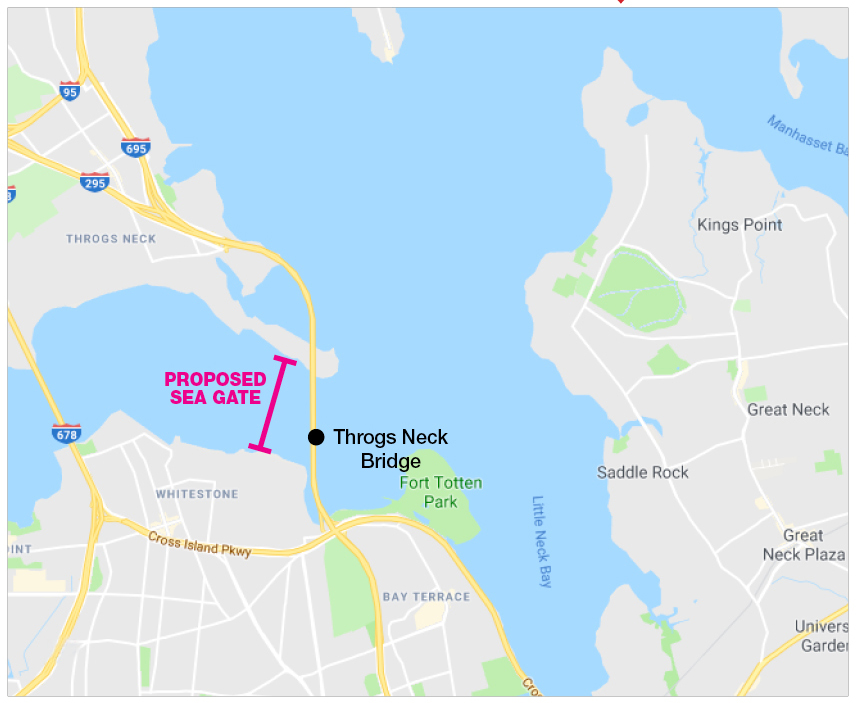
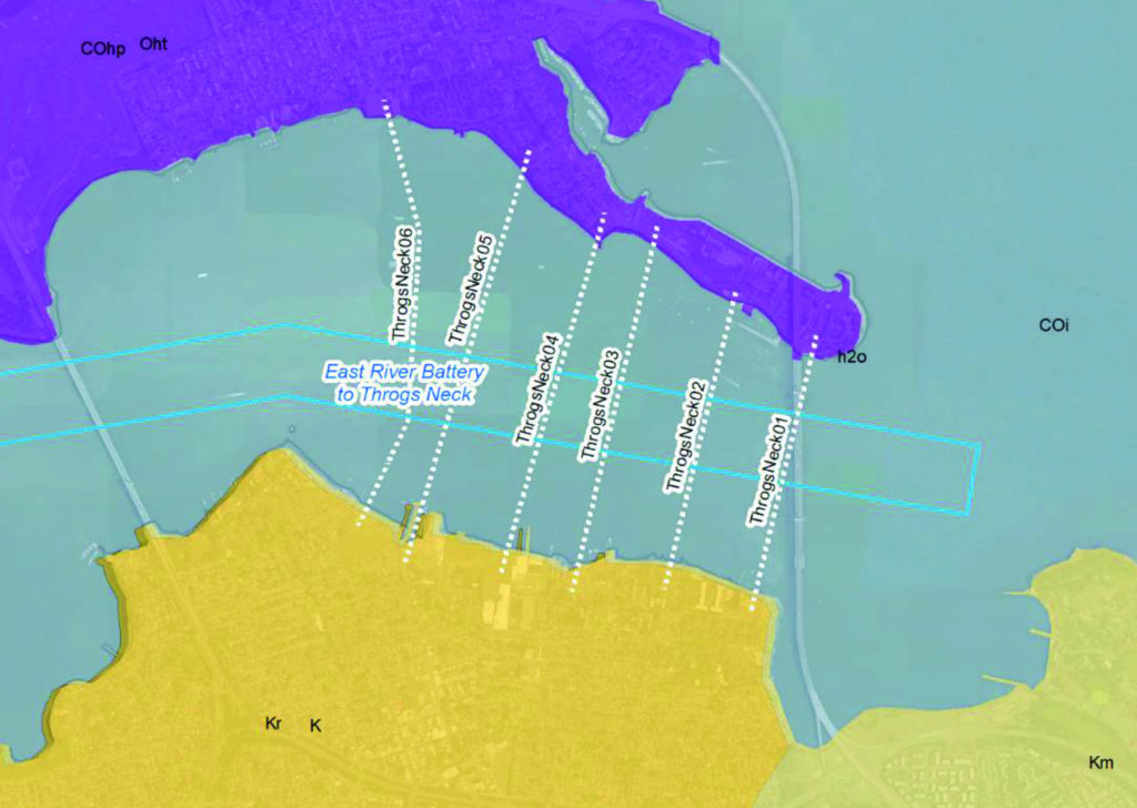
An interim report was released by the Army Corps in February that proposes five alternatives, including one that involves putting a sea gate in the East River near the Throgs Neck Bridge which could affect the North Shore of Long Island. The sea gate or storm surge barrier would be in the water, from the sea floor to well above sea-level, and span the whole width of the river. The gate would be left open to allow boating and fish migration and would only be closed when a potential storm was approaching the area.
In the interim report, Alternative 1 involves no action at all by the Army Corps. Alternative 2 involves two sea gates, Sandy Hook-Breezy Point Barrier and the Throgs Neck Barrier, costing an estimated $118 billion and taking approximately 25 years to build. The Army Corps’ net cost-benefit analysis is $57 billion for this project.
Alternative 3A has the Throgs Neck Barrier and the Verrazano Narrows Barrier, Arthur Kill Barrier, Pelham Barrier and the Jamaica Bay Barrier, costing an estimated $47.1 billion and taking about 18 years to construct. The net cost-benefit analysis is $124 billion.
Alternative 3B would not include the Throgs Neck Barrier, but have the Jamaica Bay Barrier, Pelham Barrier, Arthur Kill Barrier, Kill Van Kull Barrier, Newtown Creek Barrier, Gowanus Canal Barrier and shoreline-based measures to NJ Upper Bay/Hudson River, NYC West Side and East Harlem costing a total of $43 billion with construction lasting nine years. The net cost-benefit analysis is $117.8 billion.
Alternative 4 contains the Jamaica Bay Barrier, Pelham Barrier, Newtown Creek Barrier, Gowanus Canal Barrier, Hackensack River Barrier and shoreline-based measures to NJ Upper Bay/Hudson River, NYC west side and East Harlem at the cost of $32 billion with a build time of nine years. The net cost-benefit analysis is $116.6 billion.
Alternative 5 has no barriers and only perimeter solutions, including shoreline-based measures to NJ Upper Bay/Hudson River, NYC west side, East Harlem, Newtown Creek and Gowanus Canal and is also the cheapest option at $14.8 billion and built in nine years. The net cost-benefit analysis is $33.8 billion.
“One of the alternatives is to do all on-shore measures and to combine them with some natural systems,” Brown said. “That’s Alternative 5 in their proposal and that is the one that shows raising the shoreline and doing shoreline hardening in areas that are hardest hit by storm surges. Also, using natural strategies, like oyster reefs or artificial reefs offshore to break waves and reduce the wave strength before it reaches the coast. We think that is the smartest way to go.”
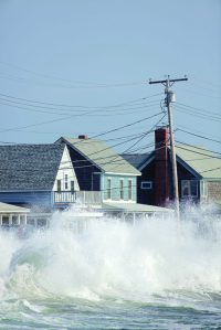
Brown and others are worried about the potential deflection and induced flooding into Long Island Sound communities when the Throgs Neck Barrier would be closed for a potential storm.
“The main question is what happens to the parts that are not protected,” said NYU Sociology Doctoral student Malcolm Araos. “What happens to the rest of Long Island that is not within the barriers? I would like to know more about the decision of how they decide to protect one area and not the other. I can imagine that being a very controversial thing that the Army Corps of Engineers would be worried about.”
In 2004, Stony Brook University Marine and Atmospheric Sciences professor Malcolm J. Bowman authored a report titled, “Hydrologic Feasibility of Storm Surge Barriers to Protect the Metropolitan New York—New Jersey Region,” where he simulated the effects of a storm surge with a barrier near the Throgs Neck Bridge. Using data from Hurricane Floyd, a tropical storm when it hit the area, the report found that a barrier would have increased sea level by one foot on the North Shore. In 2013, the American Society of Engineers published a similar study that involved a Category 4 hurricane and found it would increase the sea-level by two feet outside the barrier.
In a Long Island Sound Study Science and Technical Advisory Committee meeting on Feb. 15, Bowman stated the need for barriers. Referring to the Sandy Hook-Breezy Point and Throgs Neck barriers, he concluded they are necessary for storm surge protection and the Throgs Neck barrier may also improve water quality in the Long Island Sound. He also said that the design of the barrier should minimize obstructions to river and tidal flows during calm weather to allow adequate flushing of the East River. Bowman could not be reached for comment.
In the same meeting, physical oceanographer and research assistant professor Phillip Orton of the Stevens Institute of Technology used modeling to show the effects of the barriers. His simulations found stronger tidal currents and mixing near the barrier gate openings, widespread reductions in tidal range, currents and mixing through the rest of the estuary, increased stratification in the estuary due to the stronger stratification and estuarine circulation and more pronounced changes during spring tides than neap tides. Orton could not be reached for comment.
Araos has been studying the response to catastrophic storms by municipalities. The barriers can be a short-term option, but he is looking at what could be effective in the long-term.
“Whatever you think about these scientific predictions of sea-level rise, if you think it is man-made or not, through geologic times in like 100 years that sea-level rise is going to eventually overcome those barriers,” Araos said. “For a very long-term view, no matter how tall you build those barriers, eventually, you will need to come up with a different solution.”
Araos believes that high slope berms and habitat parks that include saltwater resilient vegetation on coastal areas can be part of the solution. Water plazas in Rotterdam, Netherlands, have also been proven to be effective and Araos feels that projects that allowing water into the community, such as canals, could be the long-term solution.
“There are three things,” said Araos, whose three-pronged approach differs significantly from the Army Corps of Engineers interim report. “One is these state-of-the-art approaches, which is about letting the water in rather than armoring up. Second, start thinking about retreat and what that looks like, how to manage with neighborhoods that are not going to be livable in 75 to 100 years. Third is the more social approach, which is social infrastructure. Investing in places like libraries or parks creates more social networks, so in a disaster, people can rely on these connections that they have made. From research, it’s known that people with bigger networks are able to bounce back from a disaster. It’s not about [physical] infrastructure and protecting yourself from the water—it’s about creating a society that is easier for you to bounce back when you deal with these disasters.”


